Weather radar

The plane can with good reason be considered a safe and reliable means of transport, just as many statistics confirm. There are, however, events that can jeopardize flight safety: one of the biggest problems is the weather, which is why planes are equipped with an on-board weather radar system to support the pilot’s choices. But how does the weather radar work?
Let’s first make a premise: the meteorological situation is the result of the presence of areas of high and low pressure and of air masses with different characteristics that, when they meet, continually create fronts and an incredible variety of clouds and precipitation. Ask all the pilots you know and everyone – or at least most of them – will answer that there is nothing more beautiful than flying when the sky is tinged with blue and the weather conditions can be said to be perfect. In commercial aviation, however, there are fixed flight times that the weather, unfortunately, does not obey to.
The greatest dangers for a flying plane are, of course, the most extreme conditions: in particular, strong atmospheric turbulence can create big troubles, especially in the event of thunderstorms. Rain in itself is not a danger, as long as it is not combined with low temperatures, high wind intensity and turbulence. During the day, these conditions – known as cumulonimbus clouds – can usually be detected with the naked eye, but at night, or when such clouds are hidden behind other stratiform clouds, the pilot’s visual perception is no longer sufficient.
A bit of history
During the Second World War, radar systems were already used on board aircraft to help pilots locate other aircraft in flight. However, the radar operators quickly noticed that extraneous signals appeared on their displays, which they did not recognize immediately.
It didn’t take long to realize that those signals indicated the interference of weather.
It must be said that already about 25 years before the Second World War, Sir Robert Watson-Watt, the father of modern radars, was already working on a method for detecting thunderstorms based on the emission of electromagnetic waves.
When World War II ended, the US Weather Bureau received 25 radars that had been used by Navy aircraft during the war. These radars called WSR-1, WSR-1A, WSR-3 and WSR-4, were modified for meteorological use and eventually distributed throughout the country.
One of the main factors that triggered the more widespread use of the weather radar was the need to tackle the problem of hurricanes. In 1954 and 1955, many hurricanes struck along the American coasts: it was then decided to earmark a budget dedicated to the implementation of radars on aircraft and on the ground.
How the weather radar works
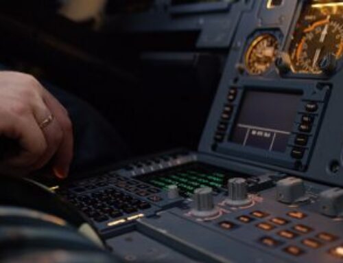
All aircraft, therefore, are equipped with integrated weather radar systems, which are usually found within the nose cone of the aircraft, in what is known as the radome. Although most of the aircraft is made of metal, the radome is constructed of a special material that allows radar waves to pass through it unobstructed.
The word radar is the acronym for “radio detection and ranging”, that is “radio detection and distance measurement”. In fact, the weather radar emits special microwaves that reflect obstacles, such as rain, hail, ice, snow and the surrounding landscape from a distance. A radar receiver captures these reflections and directs them to the system.
Clouds are made up of “pockets” of water droplets and have more or less reflective surfaces: the ones that reflect the most are rain and snow and hail when they are in the “humid” or “wet”; state; in contrast, hail, dry snow and ice crystals are less reflective.
In addition to the presence of drops, the radar system also detects movements. If there is an area of turbulence, this becomes “visible” due to marked changes in the speed and direction of movement of the water droplets. The weather radar can detect them and provide the pilot with a detailed image of the intensity, size and direction of the area affected by turbulence.
The radar therefore scans the skies in front of the plane both horizontally and vertically; since radar systems cannot search along the curve of the Earth’s surface, but only in a straight line, the emitted radar beam is constantly adjusted. It can be set to several degrees higher or lower: this is essential during take-off and landing, where the plane is tilted at a much higher or lower angle than when cruising.
Another problem can arise when a large humid cloud hides another cloud behind it. In such cases, the microwaves are reflected and attenuated by the cloud in front, while the other one remains hidden in a sort of “radar shadow”. Therefore, not all precipitation can be detected by the radar and it is important that a pilot is able to evaluate all the information that the system provides him/her to make the right choice. However, modern radar systems are able to alert pilots of situations of strong attenuation due to the presence of a cloud that could obscure what is behind it.
Effect on the flight path
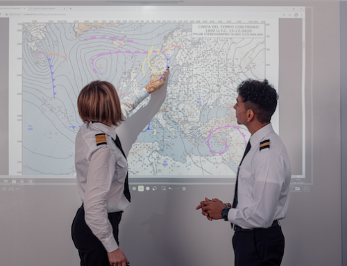
Using the information gathered, the air traffic control personnel and the pilot work together to select a new route. The sooner the pilot can determine the need for a change of route, the less he/she will have to deviate it. Night flights, more specifically, require quick reactions.
At best, passengers remain unaware of this situation. Often all they see is a distant storm: it is only the aircraft’s state-of-the-art instruments, such as weather radar systems, as well as the experience of the crew that allow to fly safely.